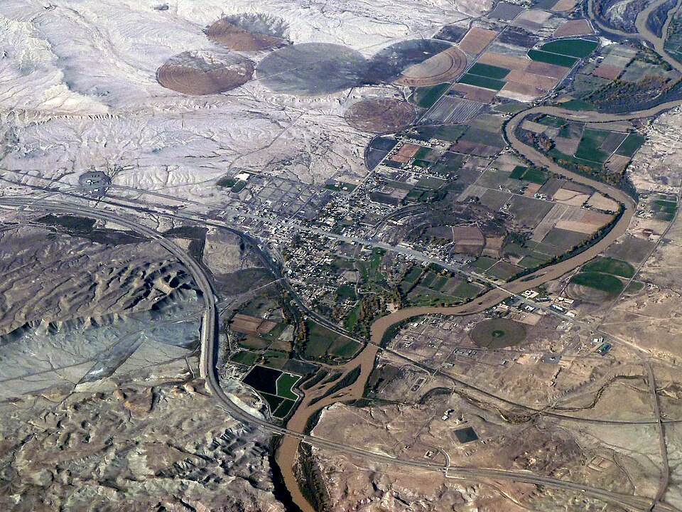
Bobak Ha'Eri · CC BY 3.0 · Wikimedia Commons
Utah
Green River: below Flaming Gorge
Clear tailwater through Red Canyon with one of the densest trout populations in the West. A, B and C sections, floated or walked on the river trail.
 RVR OPS
THE FULL RVR OPS WATER GUIDE
Discover 770 fishing locations in Utah, with lakes, rivers, public access references and official sources.
Bobak Ha'Eri · CC BY 3.0 · Wikimedia Commons
Utah
Clear tailwater through Red Canyon with one of the densest trout populations in the West. A, B and C sections, floated or walked on the river trail.
Utah
Canyon stream above Logan with roadside access and native Bonneville cutthroat higher up.
Utah
The Middle Provo below Jordanelle and the Lower below Deer Creek, both close to Salt Lake and Provo. Heavy pressure, lots of fish.
Utah
Brown trout water below Rockport and Echo with walk-in access agreements on private land. Check which sections are open.
Utah
Fish Utah map water (DWR). The pin marks the water's map center, not an entrance, ramp or parking area. Directions (DWR): From Ephraim, head east on UT-29 for about 10 miles, turn right toward Skyline Dr, left to stay on Skyline Dr, right at Skyline Dr/UT-29 and then follow the road for approximately 7 miles. From Orangeville, head west on UT-29 for approximately 28 miles to Petes Holes Reservoir, the Academy Mill Reservoir trailhead is on the east side of the lake. Follow the trail east approximately 1 mile to find this secluded reservoir. DWR page updated Oct 20, 2026. Map capture Nov. 12, 2026. Check land ownership, posted rules and current orders before you go.
Utah
Fish Utah map water (DWR). The pin marks the water's map center, not an entrance, ramp or parking area. Location: The majority of fishing opportunity takes places along Hwy 92 in American Fork Canyon. (Central Region). DWR page updated Jul 20, 2021. Map capture Nov. 12, 2026. Check land ownership, posted rules and current orders before you go.
Davis County
Utah community fishery · Restrooms. There is no wheelchair access. Fish: Rainbow trout, largemouth bass, bluegill, channel catfish and common carp
Utah
Fish Utah map water (DWR). The pin marks the water's map center, not an entrance, ramp or parking area. Location: Next to Adams Park at 1725 E. Gordon St. in Layton. DWR page updated Jun 6, 2023. Map capture Nov. 12, 2026. Check land ownership, posted rules and current orders before you go.
Utah
Named river geometry from the same national river layer used by RVR OPS. This identifies the water, not permission to fish or cross private property.
Utah
Named river geometry from the same national river layer used by RVR OPS. This identifies the water, not permission to fish or cross private property.
Utah
Named river geometry from the same national river layer used by RVR OPS. This identifies the water, not permission to fish or cross private property.
Utah
Fish Utah map water (DWR). The pin marks the water's map center, not an entrance, ramp or parking area. DWR page updated May 27, 2025. Map capture Nov. 12, 2026. Check land ownership, posted rules and current orders before you go.
Utah
Named river geometry from the same national river layer used by RVR OPS. This identifies the water, not permission to fish or cross private property.
Utah
Named river geometry from the same national river layer used by RVR OPS. This identifies the water, not permission to fish or cross private property.
Utah
Named river geometry from the same national river layer used by RVR OPS. This identifies the water, not permission to fish or cross private property.
Utah
Named river geometry from the same national river layer used by RVR OPS. This identifies the water, not permission to fish or cross private property.
Utah
Lake / reservoir mapped in Utah. Explore its location, nearby access and available agency information.
Utah
Named river geometry from the same national river layer used by RVR OPS. This identifies the water, not permission to fish or cross private property.
Utah
Fish Utah map water (DWR). The pin marks the water's map center, not an entrance, ramp or parking area. Location: Washington County. Directions (DWR): Drive 25 miles northwest of St. George on SR-18, or south from Enterprise. DWR page updated Mar 9, 2023. Map capture Nov. 12, 2026. Check land ownership, posted rules and current orders before you go.
Utah
Fish Utah map water (DWR). The pin marks the water's map center, not an entrance, ramp or parking area. Location: Juab County near Calleo, Utah. Directions (DWR): Take UT-132 West from I-15 in Nephi toward Delta Utah, west or right on Brush Wellman Road 174/Brush HWY, turn left onto the Weis HWY (gravel Rd) go west to Snake Valley Rd, right or north on Goshute Canyon Rd near the CCC Campground, left onto the north Middle Creek Rd. DWR page updated Apr 23, 2020. Map capture Nov. 12, 2026. Check land ownership, posted rules and current orders before you go.
Utah
Named river geometry from the same national river layer used by RVR OPS. This identifies the water, not permission to fish or cross private property.
Utah
Lake / reservoir mapped in Utah. Explore its location, nearby access and available agency information.
Utah
Fish Utah map water (DWR). The pin marks the water's map center, not an entrance, ramp or parking area. Location: Northern Utah. Directions (DWR): From Logan, drive 38 miles east on Highway 89. DWR page updated Jul 14, 2020. Map capture Nov. 12, 2026. Check land ownership, posted rules and current orders before you go.
RVR OPS FOR IPHONE
Live flows. Fishing forecasts. Access and local knowledge, together on your iPhone. Make a plan before the first cast.